
When Kathy and I visited the Route 66 museum in Joliet Illinois, we told the guy behind the counter that we did the route halfway in 2012. Interestingly, he asked, “What was your favorite state?” We thought about it for just a moment and both of us answered with “Missouri”.
Missouri has about 300 miles of road that was designated as the Mother Road. As the Interstate system was developed, I44 through Missouri pretty much flowed with Route 66, which traversed the width of the state in a southwest direction from St Louis, along the northern edge of the Ozarks.
Even though there are many sections of 66 that are today’s frontage road to I44, they’re still pretty, rolling over the hills and skirting the woods that were cleared for the wide Interstate. The best parts of the route, however, are when the original route veers away from the interstate into the forested and hilly countryside of the Ozarks, over the creeks and rivers on concrete and metal bridges from the 20’s and 30’s that are still in use today.
We traversed Missouri in two days after spending a night in St Louis. We followed some of the early configuration just out of St Louis, then settling in on the route that had pretty much stabilized by the later 30’s.
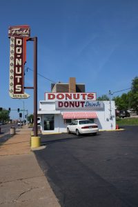
Before we hit the road, we stopped for some sweet treats at a St Louis Route 66 icon, Donut Drive In. Although the Donut Drive In was a bit of a latecomer to Route 66 (it opened in 1952), it’s style and accessibility to the traffic made it a hit. Having good donuts helped!
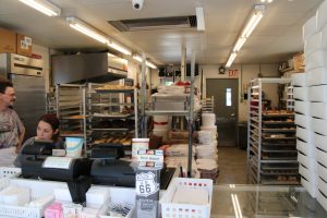
With donuts in hand, we hit the road.
Roads of Missouri
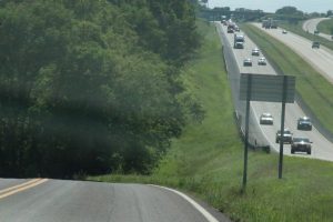
I44 pretty much follows the old Route 66 on its southwesterly run through Missouri. The land is rolling wooded hills with lots of rivers and creeks. The newer interstate overpowers the old US highway where they run parallel, relegating the Mother Road to the status of a frontage road. Still, the original highway is a proud frontage road, a pretty ride, with mature trees close to a road that runs up and down the rolling hills a bit more than the Interstate that was designed flatter and straighter to satisfy the motorists desire for faster and more uniform speeds.
Unlike the newer interstate, the old road seems to pull the driver who’s interested into the countryside to experience the joy of the journey, the beauty of the land. Along the way are the ghosts of old billboards inviting drivers to stop and visit motels, cafes, and attractions along the way.
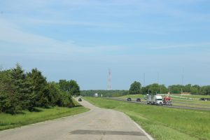
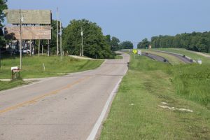
At spots along the way, the frontage road veers into the woods to take on a life of its own, meandering through the woods, over hills, past farm fields and into the small towns along the way that the Interstate has now passed and left behind.
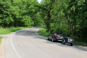
It was these stretches of the old Route 66 that were so captivating when we drove through Missouri in 2012. They were a thoroughly enjoyable ride again.
Bridges of Missouri
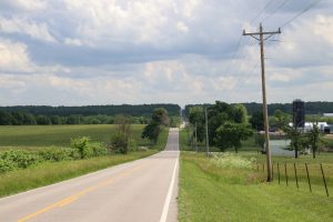
The ride through Missouri was pretty, with lots of thick, green woods. Rivers and creeks were everywhere and where there’s water running through the country side, there are bridges to carry the road.
One of the first bridges we saw hadn’t faired too well in the last few years. The bridge originally carried Route 66 traffic over the Meramec River. It was built in 1932 and was finally closed to traffic in 2009 due to advanced degradation. The bridge, though stripped of its road deck, is still standing proudly in the Missouri Route 66 State Park. There is a group that is trying to develop a plan to save the bridge, possibly making it available to foot and bicycle traffic.
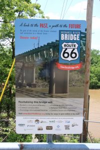
Hopefully, the project will be successful and future generations will be able to enjoy the bridge and its historical significance.
Down the road a bit, we found two even older bridges that are doing a bit better.
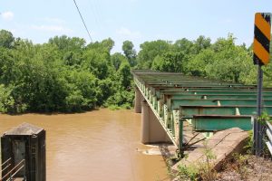
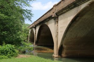
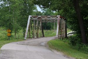
The 1923 Devils Elbow Bridge is a steel through truss bridge, constructed with hot rivets, is still in service on an old alignment of Route 66 over the Big Piney River. Its an interesting and picturesque bridge as the approach curves onto the bridge over the quiet river.
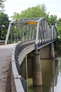
The bridge was rebuilt in 2013 and has been added to the register of historic places.
The Elbow Inn anchors the bridge on its eastern edge. The bar uses the original 1929 Munger Moss Café building.
I think the bridge still survives because of a change in the road alignment that occurred in the early 1940’s. Because of the war efforts and increased activity at nearby Fort Leonard Wood, there was a large increase in military and truck traffic at Devils Elbow. The curvy road and narrow bridge often led to delays with deliveries and movement of military equipment.
To improve traffic, the government decided to straighten and expand Route 66 to four lanes across the Big Piney River. To do this, an approach to the river had to be cut through the ridge of bedrock on the east side of the river, resulting in what was, at the time, the deepest cut in the US at just over 90 feet deep. The cut can still be traversed by those who leave the interstate to experience the old Mother Road.
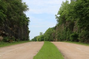
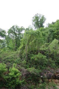
The cut is still impressive today, and rather pretty with the kudzu covered trees clinging to the top of the cut.
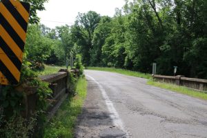
Just down the road in Waynesville Missouri is another survivor from 1923, the Roubidoux Creek bridge. This bridge is also showing its age, but it still carries a fair amount of traffic through Waynesville as Business I44 and Missouri 17. Based on some reports I’ve read, there are attempts to find ways to keep the bridge functional for historical purposes.
An interesting historical note for Route 66 through Waynesville is that it actually follows the many Indian trails that passed through the years, including the Trail of Tears. One of the reasons the area was so popular with the Indians was that Roubidoux Creek is spring fed, and the area was abundant with woods. The spring, only about two tenths of a mile from the bridge, was an interesting visit.
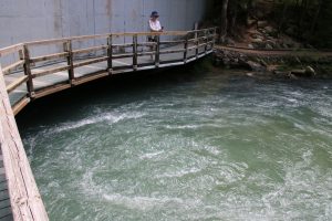
Roubidoux Spring is no small spring, providing a whopping continuous water flow of 435 gallons per second to feed the creek.
These were some of the more noted bridges we drove across following the original Route 66, but they weren’t the only ones. There were many more, both steel and concrete, from the early 20’s into the early 30’s that have survived and can still be enjoyed. These are some of the older ones we traveled on:
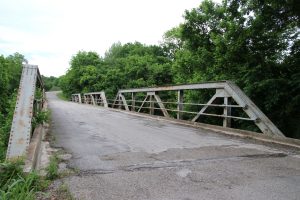
 1926, Through Truss Steel Bridge
Granted these bridges are not carrying the huge amount of traffic that use the interstate system, I still find it remarkable that they are providing safe transport for interested travelers today. They are also a great historical reference to how important the ability to travel was to the growth of our country.