Tulsa to Oklahoma City – The Road Turns West

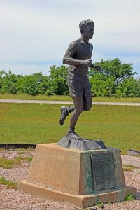
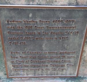
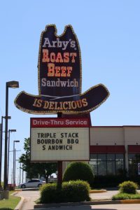
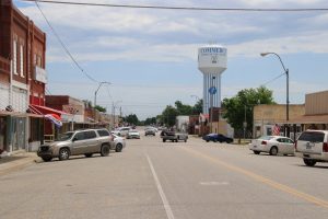
After Tulsa, Route 66 continues to the southwest for only a bit before reaching Oklahoma City, where it takes a distinct turn to the west. At the same time, the landscape starts to transition from the wooded hills of the east to the more open and flatter plains of the west. From Tulsa to Oklahoma City, the Mother Road goes through a rapid succession of smaller towns – Sapulpa, Bellvue, Bristow, Depew, Wellston, Stroud, Davenport, Chandller, Warwick, Wellston, Luther, Arcadia – before reaching the westward turning point of Oklahoma City.

As we cruised down the road, there were several places we passed that captured our attention and provided background to the historical aspects of the road.

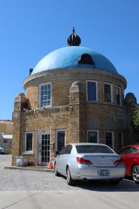
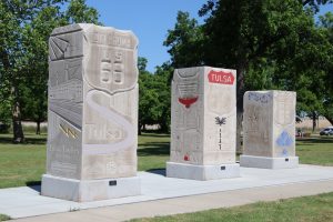
Sapulpa and 66 Foot Gas Pump

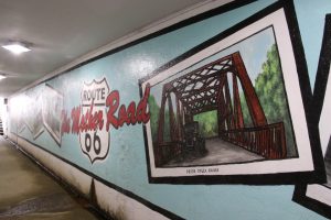
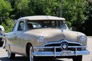
To quote Jerry McClanahan (EZ 66 Guide for Travelers, 4th Edition), “Old 66 is full of larger than life people, animals and objects” and it doesn’t take long for anyone following his guide to get caught up in noticing the “Giant” and “Big” things on the route.

I can’t fully recall the reason, but the appearance of a giant gas pump on the horizon garnered Kathy’s interest as a photo op, something to send to her brother in answer to a challenge he issued. We kept our eyes on the sight and ended up following the road to the Heart of Route 66 Auto Museum. The iconic 66-foot-tall gas pump was built as a beacon to draw travelers to their recently opened museum just off Route 66.

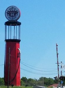
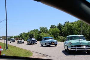
Though we didn’t take time to tour the museum ourselves, it did appear to be sleek and well curated. In fact as we were pulling out to continue our drive down the road, there was a huge contingency of old, well restored cars pulling in to visit.

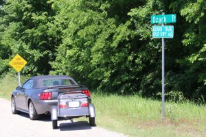
Just Outside Sapulpa – Three Miles of Original Route 66

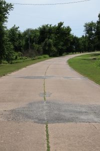
We left Sapulpa on the last iteration of four lane Route 66. Just west of the city we veered to the right onto a quaint 3.3 mile stretch of old, pre-1952, Route 66.

The original 66 used an already well-developed stretch of road through this part of the state, a road that was based on the old Ozark Trail. The relatively well-developed infrastructure made it easy to incorporate the road into the new national highway

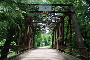
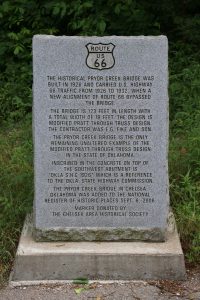
The first thing we saw pulling on to the road was the Rock Creek Bridge, a Parker through-truss bridge, built in 1921 to serve this stretch of the Ozark Trail. One of the aspects that made the bridge special was that it was constructed with a brick deck.

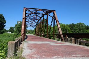
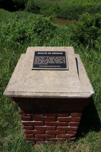
The bridge was listed on the National Register of Historic Places in 1995. Though it has a weight limit of 4T and is clearly marked for low clearance with a 7’2” height limit, it still carries traffic today down this historic bit of Route 66.

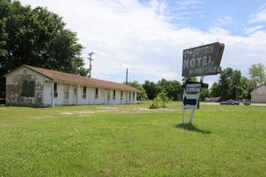
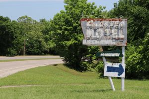
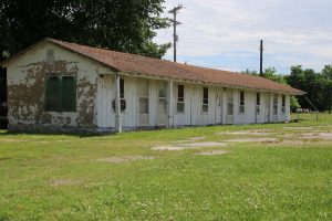
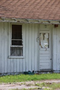
Just after the bridge, an overgrown structure on the left side of the road caught my eye. It was an early drive-in theater screen. Staked in the tall grasses alongside the road near the property was a “For Sale” sign.

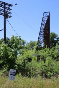
Heavily overgrown, the drive in was long abandoned. Besides the screen, it was possible to make out the remains of the ticket booth and the small projection/concession stand in the open area where the cars would park.

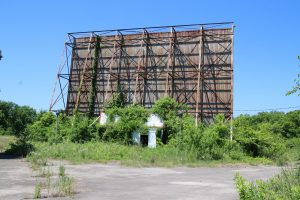
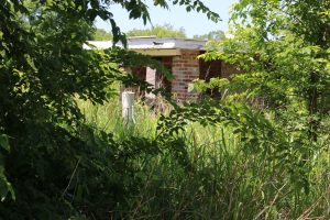
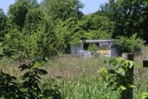
A bit of on-line research showed the property to be the former TeePee Drive-In, built in 1950 on what was then Route 66. It had space for 400 cars, and it remained a business until it was abandoned in 2000. Based on comments that I found online, there are quite a few people in the area that harbor fond memories of the TeePee in its early years.

There was a failed attempt at a restoration in 2012, and now the property is up for sale again. The ad by Coldwell Banker suggests “restore drive-in to its former glory or develop something entirely new.” I could easily envision a restoration to the glory of a drive-in museum, maybe with concessions available all day, a memorabilia store, maybe special shows on in season weekends of nostalgic drive-in flicks. Here’s hoping someone comes along who can plan and market a restoration to all the visitors traveling Route 66.

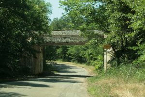
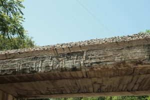
Leaving the drive-in behind us, we continued down the gently winding stretch toward the point it rejoined the four lane highway. Just before we reached the end, we passed under a low and narrow railroad overpass that dated back to 1926, still in use on a branch line (the Stillwater Central) today.

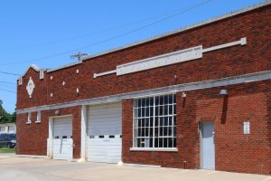
Kudos to Bolin Ford in Bristow – Protecting the Past

The drive through Bristow would have been uneventful if I hadn’t researched a reference to an historic car dealership before the trip. The Bristow Motor Company began as the first car dealership in the county in 1923 and it continues as a car dealership today.

Until December 2008, Bolin Ford operated their dealership on the entire city block in the historic 1923 building as well as two other historic buildings that were built in 1925 (on the corner at the other end of the block) and 1927 (as a “filler” between the two older buildings). That fateful December a fire broke out in the 1925 building and destroyed it while causing extensive damage to the other two historic buildings.

Despite the economics of the era, Bolin Ford elected to rebuild the dealership in a 1920’s style, managing to save the 1923 and 1927 structures. Though the 1925 building on the corner which housed the entrance to the dealership has been newly constructed, it blends seamlessly into the 1920’s vintage buildings on the rest of the block.

Rebuilt Bolin Ford today
The original 1923 and 1927 brick buildings that were saved
Restored side street facade of original 1923 Bristow Motors

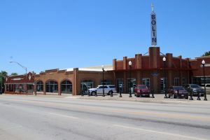
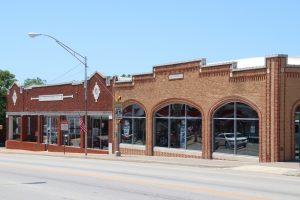
Kudos to Bolin Ford for recognizing the historic value of their property and continuing business on Route 66. Instead of taking the easy way out just building another big box car dealership, they made a concerted effort to preserve their history.

Chandler – One of the Most Interesting Museums on the Mother Road

After Bristow, we worked our way down the road to Chandler. We had one stop planned for Chandler, but we also found another gem as we went through town.

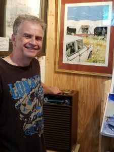
Chandler is home to artist Jerry McClanahan and his Route 66 Gallery is just off the route. Jerry is also the author of the EZ 66 Guide For Travelers, now in its 4th Edition. Jerry started traveling Route 66 with his family during the 60’s and his love for the road turned from hobby to livelihood in the 90’s.

The EZ Guide can easily be described as the bible for anyone making the pilgrimage on Route 66. We used it for our first trip on the road in 2012 and we upgraded to the latest edition for this trip. It is the best base resource for anyone making a trip on Route 66. Now that we stopped at his gallery, our latest edition is an autographed copy!

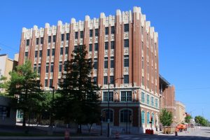
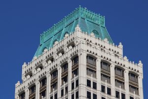
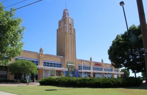
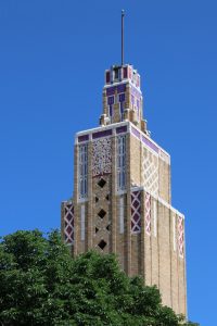
As we were driving through Chandler, we found what was probably one of the most interesting museums on Route 66 when we passed a 1937 Armory that has been restored. The Armory was built as a WPA project and it stands proudly at a wide left turn as Route 66 heads into town from the east side. The Armory was solidly built from local sandstone, the large blocks individually hewn and fitted. The building was used through 1971 when the National Guard moved to a new facility.

By the 90’s, the building had fallen into disrepair and there were thoughts about demolishing it. The local citizens prevailed, had it listed on the National Register and by 1998 a restoration group was organized.

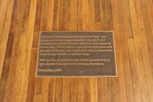
The restoration was completed in 2008 and includes a civic event space with a restored section of the original drill floor.

An interesting part of the restoration involved paying homage to the Mother Road that ran past its doors with the creation of the Chandler Route 66 Interpretive Center, now housed in the restored Armory. The Center is unlike any other Route 66 museum, investing heavily on video and pictures to tell the story of the Road. There are several video stations in the center that have large TV’s set up that play videos telling bits of the Route 66 story from different eras. The seating for guests is provided by actual seats from a Model A Ford, a 1940’s vintage Willys Jeep, and the seats from a 1965 Mustang. There’s also a video station that plays videos about the classic motels and neon signs that can be found on the Route, where guests can lie back on a bed to watch the movies.

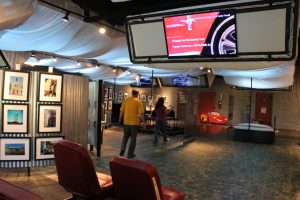
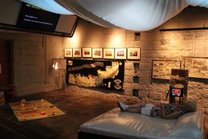
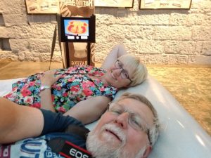
The Armory was a great stop, an interesting historical building and example of a fantastic restoration. Adding the well curated and interesting Route 66 Interpretive Center was a great idea, pulling in visitors from all over the world as they drive Route 66.

Luther – A Bit of Black Americana on the Mother Road

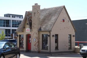
While researching things to see on Route 66, one of the sources I used was a site curated by the National Park Service and dedicated to preserving the heritage of Route 66 (https://www.nps.gov/Nr/travel/route66/index.html). The website included a great list of sites along the route that are listed on the National Register of Historic Places. While perusing the sites in Oklahoma, there was one in particular that stood out and called to me, the Threatt Filling Station. After reading the history of the station, I knew I would stop to take pictures and consider its past.

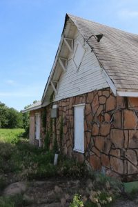
At just about three miles out of downtown Luther, we came up on a quiet intersection of US 66 and Countyline Road. The Threatt Filling Station stands alone at the intersection, lonely, by itself on the southwest corner.

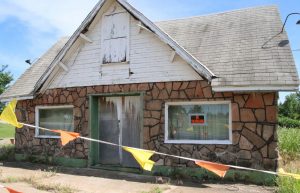
I have to admit that there doesn’t seem to be anything special about the somewhat dilapidated structure. I’m sure most people would drive right by, not giving the building a second thought except maybe to think it’s time someone should tear it down. But the structure has an important history.

It was built in 1915 by Allen Threatt as a “house type” gas station using design elements popular during the time. The building was built using local sandstone and incorporated wide classic eaves on all four faces. It was set back just enough from the main highway to allow a couple gas pumps out front.  What really sets it apart from the other historic sites along Route 66 is that Allen Threatt was African American and the Threat family homestead, on which the filling station was built, represented economic opportunity for the Threat family.

The station benefited from its location on Route 66 once the highway was commissioned, and it became a popular roadside stop for travelers through the 1950’s. It was one of the few places on Route 66 where people of color were welcome.

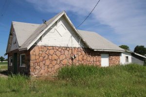
In all my enthusiasm to travel the Mother Road, I hadn’t really thought about how Black Americans would have been viewed during the height of the roads popularity. In fact, Blacks traveling Route 66 needed to be much more cautious and they had to stock up for their trip much more carefully because there were many stretches where they were not welcome. Safe refuges like Allen Threatt’s Filling Station were probably welcome sites for traveling Black families.

Oklahoma City – Lake Overholser Bridge

After our reflective stop in Luther, we continued down the road to Oklahoma City and westward to our stop for the night in little Hinton, Oklahoma. It was late afternoon and we still had about 90 miles to the motel. For travelers on today’s interstates, 90 miles may not seem like much but for the way we were traveling (two lane roads, side trips through small towns, city streets through Oklahoma City), the 90 miles left could easily take 2 ½ to 3 hours.

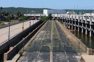
With the sun dropping in the sky, we worked our way through Oklahoma City, catching glimpses of some of the older and more interesting buildings along the route. As we reached the west side of the city, we took an older configuration of Route 66 which took us to a 1924 steel truss bridge that served the Mother Road from 1925 to 1958.

The original bridge was built in 1924 and opened to traffic in 1925 after massive 1923 floods wiped out every bridge in Oklahoma City. With a 20 foot wide roadway, the new bridge was wide for its time. The design was elegant and balanced using a combination of newer (for the era) truss construction spans, with pony truss spans at each end  leading to four Parker through-truss spans over the North Canadian River flats that lead into Lake Overholser. The overall span of the bridge is 748 feet long.

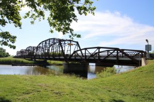
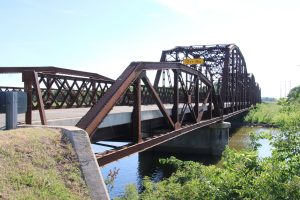
As the traffic on Route 66 exploded into the late 50’s, the 1925 bridge was getting stressed and the highway route was relocated to a new four lane just north of the existing bridge. The older span remained open to local traffic, but was closed to traffic in 2008 because of deterioration.  The historical significance of the bridge was recognized and Oklahoma City invested $4 million dollars to refurbish the bridge, which reopened to traffic in 2011.

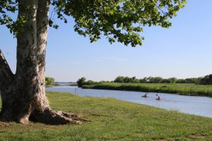
Today, the historic bridge is the centerpiece of the northern gateway to the recreational area surrounding Lake Overholser.

With this last serene stop under our belt, we headed west into the setting sun and our last night in Oklahoma, a small hotel in Hinton. From there, it would be about 100 miles to Texas and on to Amarillo.

Tulsa Oklahoma – East Meets West

After cruising through the small towns of northeast Oklahoma, Tulsa felt different. Obviously, the city was much bigger than any of the Oklahoma towns and cities we’d driven through, but it also had a newer, “hip”, boom town feel. Tulsa had been built on oil, declined a bit during the last recession, and has done a great job of bringing in new businesses and industries to expand the city.

As far as Route 66 is concerned, Tulsa was the home to Cyrus Avery and it was in Tulsa that the idea for the highway was conceived and developed. Tulsa became a hub on the new highway when it was officially designated. Today, the city readily embraces its heritage and relationship with Route 66.

Our hotel in Tulsa was a restored older hotel right on the original Route 66. The Max Campbell building was built in 1927 on the western outskirts of town, at the end of a trolley route from downtown Tulsa. It faced the new highway and was designed for a large number of commercial businesses on the first floor with a hotel, the Casa Loma, occupying the second floor. The second-floor hotel was accessed by a grand staircase that had an entrance on the main street.

The hotel serviced travelers on Route 66 and also travelers arriving by train who could take the trolley to the hotel that offered more affordable lodging than what was available in the downtown area.

The building came under the ownership of a company with an eye to revitalizing the neighborhood in 2009, and it has been restored as an upper level boutique hotel.

At the top of the Grand Staircase

The rooms are “themed”, and we had the Tulsa Art Deco Room, with a dark and metallic décor reminiscent of the roaring 20’s.

After breakfast the next morning, we headed out from the hotel to explore a bit of Tulsa before getting back on the highway to the western side of Oklahoma.

Driving down 11th Street, the original route of the highway into downtown Tulsa, we saw quite a few signs reminiscent of the original highway. Some of the neon and chaser lighting graced existing businesses that recognized their historical value and a few businesses that let the signs fall into disrepair.

Just before getting to the downtown area, we passed a historic 1940’s Meadow Gold Dairy sign that has been preserved and restored, placed atop a special brick pavilion, designed to display it, with plaques to tell the story of the signs history.

It’s inspiring to see these items from our cultural history being attended to and preserved. In this case, the work was made possible partly due to a grant from the National Park Service Route 66 Corridor Preservation Program, and the committed partnership of the Tulsa Foundation for Architecture, the City of Tulsa, and the Oklahoma Route 66 Association, who all made significant contributions to the effort to save the sign.

When we got to the downtown area, we saw two iconic gas stations from the early days of Route 66 that have been or are being restored and repurposed.

The first station was a 1931 Phillips Petroleum station. Phillips was looking to cash in on the routing of Route 66 and purchased a residential property for conversion to the gas station. The station was designed in a quaint cottage design. A second building for service bays in a matching architectural style was also built and is still on the property.

Phillips ran the station as a corporate entity for a number of years and then started leasing it out to individual entrepreneurs. The station remained popular and productive through the 50’s and into the early 60’s before rerouting of the highway to the super slabs drew down traffic. The station closed in 1973 and the property continued life as a property for paid parking and fell into disrepair. In the early 2000’s, a new owner recognized the historic value of the property and took on restoration after the property was listed on the Register of Historic Places. The efforts resulting in the successful repurposing of the property as a car rental service for downtown Tulsa. The rental office uses the gas station, and the building with the service bays is used to prep and clean the returned vehicles.

A second gas station in the downtown area defines a gentrifying commercial neighborhood  and is on a path to restoration as a historical property to be used as an intimate event space. The Blue Dome building is located on the early routing of Route 66, was built in 1924, opened as a White Star Gulf Station, and served as Tulsa’s first 24 hour gas station.

An interesting aspect of the station design (besides the eye catching blue dome) is the fact that the station is a two story structure. In fact, because the station was designed as a “24/7” business, the company felt it was important to have the operator always available and the second floor was designed as living quarters.

The Blue Dome didn’t last that long as a station; it’s reported that sometime in the 30’s it was repurposed as a bar, moving through a number of owners. Finally, in 2013, nearby bar owners with an interest in historic value purchased the property with an eye for renovation. It’s an icon for the neighborhood and hopefully will someday be available as a cozy public/private event space.

As we drove through the downtown area, we noticed a large number of well-kept art deco style buildings that proved an interesting architectural find. Historically, the city experienced a building boom in the early 1900’s that coincided with the rise of art deco architecture in the United States and resulted in many art deco buildings dotted through the downtown and midtown areas. The impressive collection of art deco buildings has attracted preservationists and many of the buildings have been restored.

As expected, the buildings include a number of office buildings.

The influence is also seen in churches built during the building boom, for example the Boston Avenue Methodist Church, built in 1929.

The art deco influence even carried over to strip mall type buildings built during the period. We saw one, the Warehouse Market,  that was built originally as a Public Market in 1929. The original building, with its ornate art deco tower, housed a variety of shops and a farmers market on one end when it opened.

By 1938, Warehouse Market, a food chain took over the building until 1978. The building floundered as a host to a variety of commercial uses until the entire property was purchased as a package by developers for a Home Depot store. Rather than tear down the iconic art deco structure, the developer saved the façade as a front for a new commercial strip mall adjacent to the big box home improvement store.

After our little tour of Tulsa’s downtown area, we worked our way to the point where the original Route 66 crossed the Arkansas River. The original 11th Street Bridge, built in 1916 and incorporating all modern features for its time, was 1470 feet long and 34 feet wide, carrying one train track flanked by one roadway and pedestrian walk in each direction. It was one of the longest concrete structures in the Midwest at the time.

The route was already busy with traffic in 1926 when it became part of the new Route 66. In 1929, the bridge was refurbished with new lighting and roadway upgrades. It was upgraded again in 1934, when it was widened to four lanes.

Much of the traffic carried by the 11th Street Bridge was rerouted in 1967 with the completion of the I244 bridges just upstream to the west. Still, the bridge deteriorated to the point it was closed to traffic in 1980 and fully replaced by a new Southwest Blvd bridge just downstream to the east.

The original bridge was listed on the National Register in 1996 and Tulsa voters approved a series of projects in 2003, one of which involves promoting and enhancing Route 66 in Tulsa. Part of the plan involved renaming the 11th Street Bridge as the Cyrus Avery Route 66 Memorial Bridge and building a Memorial Plaza and Park leading to the bridge. The Plaza includes a bronze sculpture titled “East Meets West”, further memorializing the Mother Road and Cyrus Avery.

Initially, the 11th Street Bridge was kept open to pedestrians, but continued degradation resulted in it being gated and closed in 2008. It’s still a centerpiece to Tulsa’s memorial to Avery and Route 66, but restoration costs to even make the bridge safe for pedestrians keep climbing. As was noted in a news report on the status of the bridge in 2009, “it’s too expensive to repair, too historic to demolish, and too valuable to ignore” (Emory Bryan, Historic Tulsa Bridge to Remain Closed, newson6.com, Posted: May 14, 2009 4:19 PM CDT).

The plaza was a great start to Tulsa’s Memorial to Avery and the Road he conceived, but finding a way to restore and open the bridge as part of the memorial would be the “crown jewel”. Here’s hoping that Tulsa finds a way to restore the bridge to centerpiece status for their Route 66 Memorial.

About a mile further down the road as we were leaving Tulsa, we stumbled on one more “gem of Route 66”, Howard Park, a relatively small roadside park dating back to 1918.

The park was created on a donation of 14 acres of land by Tulsans O.R. and Inez Howard. The land was nestled between an early oil refinery and what would become a major railway yard. Still, the forested property offered a green respite for the residents of Red Fork and west Tulsa. As the road alongside the park grew to be a major highway, the park was also a favorite spot for passing motorists to take a break, sometimes turning the park into an informal tourist camp.

In 1990, Howard Park was dedicated as an historic US 66 park. By then, the park had shrunk in size by about half when I244 was constructed land between the park and rail yards. Despite the encroachment of the interstate, the park and its mature trees and green space still offers a bit of a quiet respite. Strolling through the park’s established trees, it wasn’t hard to imagine the giggles and laughter of kids running around playing tag while Mom and Dad got out the fixings for a picnic lunch during a road trip in the 40’s or 50’s.

Recognizing the historic value of the Park, the City of Tulsa commissioned the creation of three stone monoliths for placement in the park. The sculptures were designed by the artist to commemorate not only Route 66 but all the things and industries that have contributed to the cultural identity of Tulsa.

The sculptures were placed prominently in the park in 2017. It was a pleasant stop before we continued down the Mother Road to Oklahoma City and beyond.

A Little Detour in Tulsa, OK

If you’ve been reading the Route 66 blog, there is a strong focus on the historical aspects of Route 66. However, the other half of Top Down Rambling (me) has another interest, and that is a passion for needlework. I have been doing some form of hand stitching for about 50 years. I’ve done cross stitch, hardanger, Temari, punch needle, felting, pulled thread, and for the last 20 years, needlepoint. Now, if you’re not into this, that last sentence came out all “Greek”, and that’s OK. The specifics aren’t relevant to this blog. What is relevant is that because of this interest, I talked my DH (dear hubby) into taking a little detour while we were in Tulsa. When we travel long distances, I like to stop in specialty needlework stores to see what that region has to offer in techniques, designs, and accessories. Often, I will find items that aren’t available in our home area.

Well, we drove to the area store and DH patiently waited outside while I perused the store. Based on my erroneous research, I thought they would have needlepoint goods. But alas, that didn’t work out. For non-stitching people, that would be like going into a grocery store when you are looking for a hammer.

But, the trip was still fruitful. Walking around and looking into every corner for something that would appeal to me, I did find a Mill Hill kit design of an old-fashioned gasoline station with two gas pumps in the foreground. Mill Hit kits are a combination of cross-stitch and beading. It would be an easy item to stitch in the car or hotel room.

Since old gas stations are one of the things we look for on this trip, this was a great stitching project to represent our trip. The name on the gas station in the design is “Joe’s Garage”. To personalize the piece a little more, I’ll change the name to “Gay Parita”, the gas station and friendly people we visited in Missouri. When it’s complete, we’ll post the finished product on the blog!

Oklahoma State Line to Tulsa – Meandering Road, Quaint Towns

US 66 enters Oklahoma to the grassy, rolling hills of the northeast part of the state and works its way to the southwest towards Tulsa. The road seems to meander through the small towns with a Midwest feel – Quapaw, Commerce, Miami (“Mi-a-ma” to Oklahomans), Narcissa, Afton, Vinita, Chelsea, Foyil, Claremore and Catoosa – many forgotten when I44 replaced Route 66. The original route crosses I44 just a couple times as it wends its way southwesterly into Oklahoma.

Commerce

Besides being the first larger city that you drive through on Route 66 when entering Oklahoma, Commerce proudly claims itself the boyhood home of Micky Mantle, aka “The Commerce Comet”. These two pieces of the city’s history are intertwined on the co-signed “Historic Route 66” and “North Mickey Mantle Boulevard”.

As with most small towns on Route 66, the highway was routed clearly through the downtown. In the case of Commerce, that would be Commerce Street.

At the end of the main drag, the highway turned to head out of town but there were two iconic businesses that tried to capture travelers on their way in or out of town. Both have been saved and restored and are classic stops for the visitors of today.

The Dairy King is at the very end of Commerce Street, squarely in the middle of the dead end road just before it turns out of town. The quaint little restaurant is hard to miss and just begs for a stop. It’s currently run as burger and ice cream shop by a Mom and son team. The place advertises that it’s the home of the one and only Route 66 cookie. Each one is hand made by Charles Duboise, son of Treva, using a cookie mold that he designed and patented.

The Dairy King is a popular stop as a burger, ice cream and cookie shop, but the business started as a Marathon Gas Station and had a stint as a rock shop in its prior lives. Today, Charles enjoys the visits from travelers and is more than willing to share his knowledge of the building’s history as well as the history of the area, including the comings and goings and activities of Bonnie and Clyde when they notoriously visited Commerce in April 1934. He keeps scrapbooks of old pictures, news clippings, and collected facts to share and show visitors.

Kitty corner from the Dairy King is another interesting and quirky Route 66 icon. Built out from the side of what appears to be a brick commercial building is the front part of a classic cottage style Conoco Filling Station.

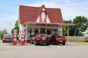
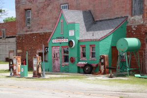
The hole in the wall Conoco Filling Station (as it’s known), was reportedly built in 1929/1930 on the west wall of the last commercial building on Commerce Street, squeezing in a gas station in the narrow piece of land between the building and the highway. Today, the small station is a souvenir/gift shop and museum for Route 66 memorabilia, and maintains a quaint symbiotic relationship with the Dairy King across the street. It probably was a bit more competitive when both businesses were gas stations in the 30’s and 40’s, competing for the passing traffic.

Chelsea

We rolled down the Mother Road as it meandered through the countryside of northeast Oklahoma and a string of the cities and towns – Miami, Narcissia, Afton, Vinita – each with its own special quaint feel and personality before making our way into Chelsea, Oklahoma.

Chelsea started as a rail town, a stop on the Atlantic Pacific Railroad. Initially just a small farm town with a train depot, the town itself gained a bit of a reputation for being the site of the first oil found in the Oklahoma territory in the very late 1800’s.

By the time Route 66 was routed through the town in 1926, the oil boom was in a downswing;  the nearby oil fields proved to be of good quality, but the volume wasn’t great and more productive oil fields were located elsewhere in the state. Still, Chelsea did have an oil refinery and a well-developed commercial district that easily switched to serving travelers on the Mother Road. Chelsea embraces its Route 66 heritage with three sites related to the highway.

Just as you enter town from the east, there is a section of the older road configuration (1926 – 1932) that cuts off to the southwest to cross Pryor Creek on the original 1926 modified Pratt through-truss girder bridge built for Route 66. The bridge is listed on the National Register and is open to traffic, albeit with a restricted weight load.

The bridge is neatly nestled into the dense woods that line Pryor Creek.

Also on the edge of town is another site that is listed on the National Register. The Chelsea Motel no longer serves as a way stop for travelers but stands as a ghost of the roadside economy that existed in small towns on the route.

The motel was built in the late 1930’s as traffic on the Mother Road started expanding. A small, family owned motel on the edge of town such as this would be an inviting place to stay after a long day on the road. Establishments like this would provide a backbone to the booming roadside economy that sprang up along the highways across the US. Glitzy neon signs would beckon travelers to stop in the quaint roadside motels to rest for the night.

The formula worked for the Mom and Pop establishments while the traffic on the highways expanded and grew. But the growth brought new challenges and the need for bigger and faster highways. By the mid 1950’s, a new turnpike opened about 5 miles southeast of Chelsea, pulling travelers off the two lane highways that networked the small towns of America and on to the faster “super slabs” that joined the more urban centers.

Today, the Chelsea Motel is privately owned and used primarily for storage, standing as a ghostly beacon to a time that was.

When 66 was routed through Chelsea, it was laid out along the tracks on the east side of town and it effectively moved the town center to the east. Route 66 became the dividing line between the east and west sides of Chelsea.

All along Route 66, as traffic continued to grow in volume, pedestrian safety when crossing the highway became an issue. A number of cities and towns along the route introduced pedestrian tunnels to help people in crossing the street. Some of these were first introduced as WPA projects in the 1930’s, but a number were also built into the 1950’s as travel on the highway exploded. This was the case in Chelsea.

Chelsea has turned their 1958 vintage pedestrian tunnel into an interesting stop along Route 66. The tunnel is open and lined on one side by  a 90 foot mural dedicated to the history of Chelsea and on the other side by a “signature wall”.

The tunnel was an interesting stop and it afforded an opportunity for a classic set of pictures from both sides of the street.

Foyil

Continuing on from Chelsea, we took a bit of a detour along the older alignment of Route 66 through the small town of Foyil, Oklahoma, known as the home of Andy Payne, winner of the First Annual Transcontinental Foot Race. The race, run in 1928, was organized by C. C. Pyle, a sports promoter from Illinois.

Pyle organized the race as a money making activity, planning promotional activities along the way. It was to be run largely on the new Route 66 and was considered a promotion for the newer highway. Pyle offered a large purse of $48,500, with a $25,000 first prize. The sizeable prize money  drew international attention in the world of competitive running.  Still, Andy Payne,  a lad of 20 years, part Cherokee from Oklahoma where he was a track athlete in high school, saw the race as an opportunity. He felt he could accomplish more in three months (the duration of the race) than he could his entire life. Andy lined up some local support and started a training regimen for the race.

When the race started in California on March 4, 1928, Andy was one of 275 entrants. By the end of California, the competitors had dropped to 145, with Payne a distant fourth place. By Amarillo, Payne had achieved second place and he barely eked into first place as he entered his home state of Oklahoma.

The fame and publicity of being the leader cost the native son in his run through Oklahoma, and he ran into Kansas in second place as one of 80 competitors.

Andy regained first place in the Chicago to New York leg, and ran into New York City on May 26, 1928 with a winning time of 573 hours, 4 minutes, 37 seconds. He claimed his first prize winnings and returned to his home state of Oklahoma, a popular home state hero.

Andy used his winnings to pay off his family’s mortgage and used the rest to invest in land that ultimately paid off when oil and gas was discovered. He got married, worked as a newspaper editor for a while and ultimately got elected as Clerk of the Supreme Court of Oklahoma, holding the position for 38 years.

Little Foyil Oklahoma hasn’t forgotten their native son. The original highway is currently named Andy Payne Boulevard and there is a small memorial park and stature commemorating his achievement.

After stopping in Foyil, we continued our drive through Claremore, Verdigris, and Catoosa to our stop for the night in Tulsa.

Route 66 Through Oklahoma – The Mother Road Heads West

In retrospect, I consider Oklahoma a transition state for Route 66. The US highway started very near the northeast corner of the state, worked its way to the southwest towards Oklahoma City and then swung almost due west as it ran towards California.

It’s also a somewhat transitory state in terms of topography. Oklahoma encompasses a wide variety of terrain and ecosystems ranging from hilly, forested regions in the northeast, near subtropical mountain regions in the southeast, with a transition to arid plains to the west of Oklahoma City. Oklahoma reportedly contains ten distinct ecological regions, more per square mile than in any other state by a wide margin. When you drive Route 66 through Oklahoma, you traverse many of these.

Oklahoma Ties to the Birth of US 66

For aficionados of the Mother Road, Oklahoma is also the home to Cyrus Avery, considered the father of Route 66. After moving to Oklahoma from Missouri in the very early 1900’s, Avery saw the benefit of well-developed roads to interstate commerce. He worked for a number of road associations through the years, ultimately getting appointed to the Joint Board of Interstate Highways in 1925. It was in this position that Avery advocated for a transcontinental route from Chicago to LA which conveniently ran through his home state of OK as well as the state of his youth, Missouri.

Although the idea for the highway was conceived and fostered in Oklahoma, the state is not considered the birthplace of the Mother Road. That honor befalls to Missouri, specifically Springfield. It was at a meeting in Springfield Missouri late April 1926 that a major impasse on the number for the new highway was settled. Avery had long wanted US 60 to be the number for his dream highway, and he had gotten all of the states involved to agree. The problem was the Governor of Kentucky, who wanted the coveted US 60 for a highway from Virginia to California that would cross his state.

The numbering stalemate had lasted six months when Avery and his team met in Springfield Missouri to look at options. Kentucky had offered US 62 as an option, but the number “60” was much coveted by both sides of the table. As a last ditch effort, Avery had asked Oklahoma’s Chief Highway Engineer John Page to assemble a list of all unused numbers for cross country highways.

The group reviewed all 24 available numbers. Word of mouth history suggests it may have been Page who noted that the catchy number “66” was still available. In any case, the number caught Avery’s whim and it was quickly agreed to by those present. By late afternoon of April 30, 1926 a telegram signed by Avery and B.H. Piepmeir, Missouri’s Chief Highway Engineer, was sent to the Bureau of Public Roads in Washington.

The telegram clearly stated the preference for US 66 over the lesser US 62 and the Mother Road was born.

One year later, Avery would be instrumental in the creation of the US Highway 66 Association to promote paving the route and promote travel and tourism on the highway. The rest, as they say, is history.