Our third day of travel was going to run longer even though it was one of our lower mileage days. After checking out of our hotel in Oacoma, we headed west on I90 towards the Badlands and Custer State Park. Our plan was to take the scenic drive through the Badlands and then head towards Custer, where we had a campsite reserved for three nights. After our stop at the South Dakota Information Center, we added one more stop for the trip – the Minuteman Missile National Historic Site just off the interstate at the Badlands exit.
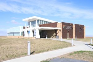
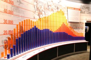
The Minuteman Missile National Historic Site is a relatively new National Historic Site having been established in 1999. The brochure piqued our interest since we were both kids during the Cold War (“duck and cover” instructions, air raid drills, bomb shelters, and, yes, missile silos). A planned quick stop at the Visitor Center turned into about a 45 minute walk through a very impressive museum display documenting the Cold War and explaining that the plains was dotted with missile silos because of the ability to strike the USSR directly and quickly by firing nuclear warheads on Minuteman II Missiles buried in underground silos all across the Great Plains. The visitor center was just the introduction to the real highlights of the National Historic Site – a restored underground missile launching bunker (open for tours, but not able to be scheduled on the day of arrival) and a restored missile silo that could be viewed from above ground. The additional sites were in two different locations over the next 15 miles of interstate and we didn’t make the stops, opting for the Badlands instead.

If we make it back, we’ll plan for the stops (probably spending more time in the Badlands as well). While at the store, Kathy decided to pick up a National Parks Passport and got her first cancellation. Now that she has the passport, our trip plans will be changed a bit to include more stops at National Parks, Monuments, and Historic Sites so she can maximize the number of cancellations she gets on this trip.
Running behind to our rough schedule, it was off to the Badlands. Before entering the park, we stopped at a gas station/convenience store, filled up the tank and bought some sandwiches and drinks for lunch along the drive through the park.
Entering the park, Kathy bought an annual senior pass for $20 that will cover all our park admissions this trip; we figured if we paid the “per vehicle” charge at each place we planned to go, it would be $40 so the annual pass was a bargain. (Twas a shame we didn’t get our permanent Senior passes before the trip…oh well…they’ll probably be there when we get home!)
First stop after paying our entrance fee was the Ben Reifel Visitor Center so Kathy could get her National Parks Passport stamped and we could learn a bit more about the park.
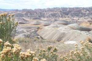
The Badlands started to form millions of years ago as a variety of rock layers were deposited on the exposed plains successively through the eons. About a half million years ago, the deposition process slowed and erosion took over. “Modern” rivers cut through the rock layers, somewhat selectively based on the type of rock, carving intricate shapes, canyon walls and pinnacles that draw visitors to the park today. What was really interesting is that the Badlands are eroding rather rapidly, about an inch a year. At this rate, the Badlands will erode completely away in another 500,000 years. It may be a good idea to see them before they disappear!
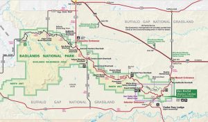
With all of our new found knowledge, we headed out on Badlands Loop Road, a 40 mile ride through the park.
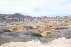
The Badlands is immense and at first just seems to be a lot of the same scenery, but when you take the time to really look at the rock formations and notice the layering and differences in erosion, the rocky landscape provides a humble introduction to the forces of nature, especially water and wind. We traveled the road just after noon and the sun was high, but stopping to look into the shadows and scanning the landscape as clouds passed, shading the sun, suggested that a single scene could take on all new dimensions depending on the time of day.
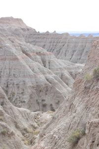
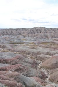
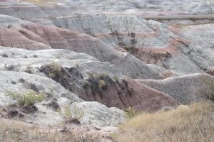
Tyler seemed to enjoy the landscape as well, demonstrating his rock climbing ability.
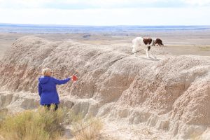
We stopped and ate our lunch at Bigfoot Pass overlook. It was sunny, but the temperature was great, mid 60’s. The wind was strong, though, so we had to be careful that our lunch wouldn’t blow away. Tyler again enjoyed an escape from the car and we took a short walk to take in the views from the overlook.
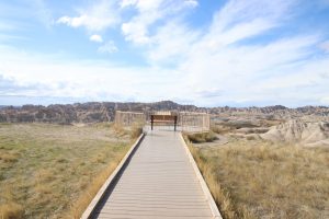
After lunch, we continued our drive through the badlands, stopping a time or two to take in the views before we continued our drive to Custer State Park and the camping experience of our trip.
We rejoined I90 at Wall South Dakota, making a quick drive through town to drive past the infamous Wall Drug. It was a bit late in the day and we were anxious to get camp setup before dark, so we decided to leave a visit to the iconic travel stop for another time.
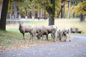
We arrived at Custer just a bit before 5PM and made a quick stop at the Camp Store to pick up some wood for a fire just before they closed. We pulled into our camp ground and found our site. As we unloaded our gear to setup camp, we watched a flock of big horn sheep as they nibbled on acorns in the camp ground.
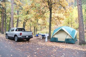
 The camp ground was quiet, about two thirds full. Our site wasn’t overly large, but it was adequate, bordered on the backside by a small creek. Across the creek was a large rocky wall.
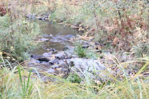
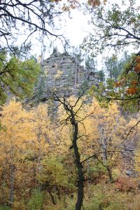
I’d find out the next morning that there was a wildlife trail winding down the rocky wall when the big horns returned for breakfast!
It had been a long day and after a quick camp supper we climbed into bed It was a cool (almost cold) night and it rained a bit. Still, we slept good and our gear kept us warm.




 The camp ground was quiet, about two thirds full. Our site wasn’t overly large, but it was adequate, bordered on the backside by a small creek. Across the creek was a large rocky wall.


